
UNESCO warns there’s close to a 100% chance of a Mediterranean tsunami
- Date:
- September 10, 2026
- Source:
- ScienceDaily.com
- Summary:
- The Mediterranean may seem far removed from the world’s major tsunami zones, but history and modern modeling show that destructive waves can strike the French Riviera with surprisingly little warning. Some tsunamis could reach shore in under 10 minutes, while past events have produced waves around two meters high, powerful currents, damage, and deaths.
- Share:
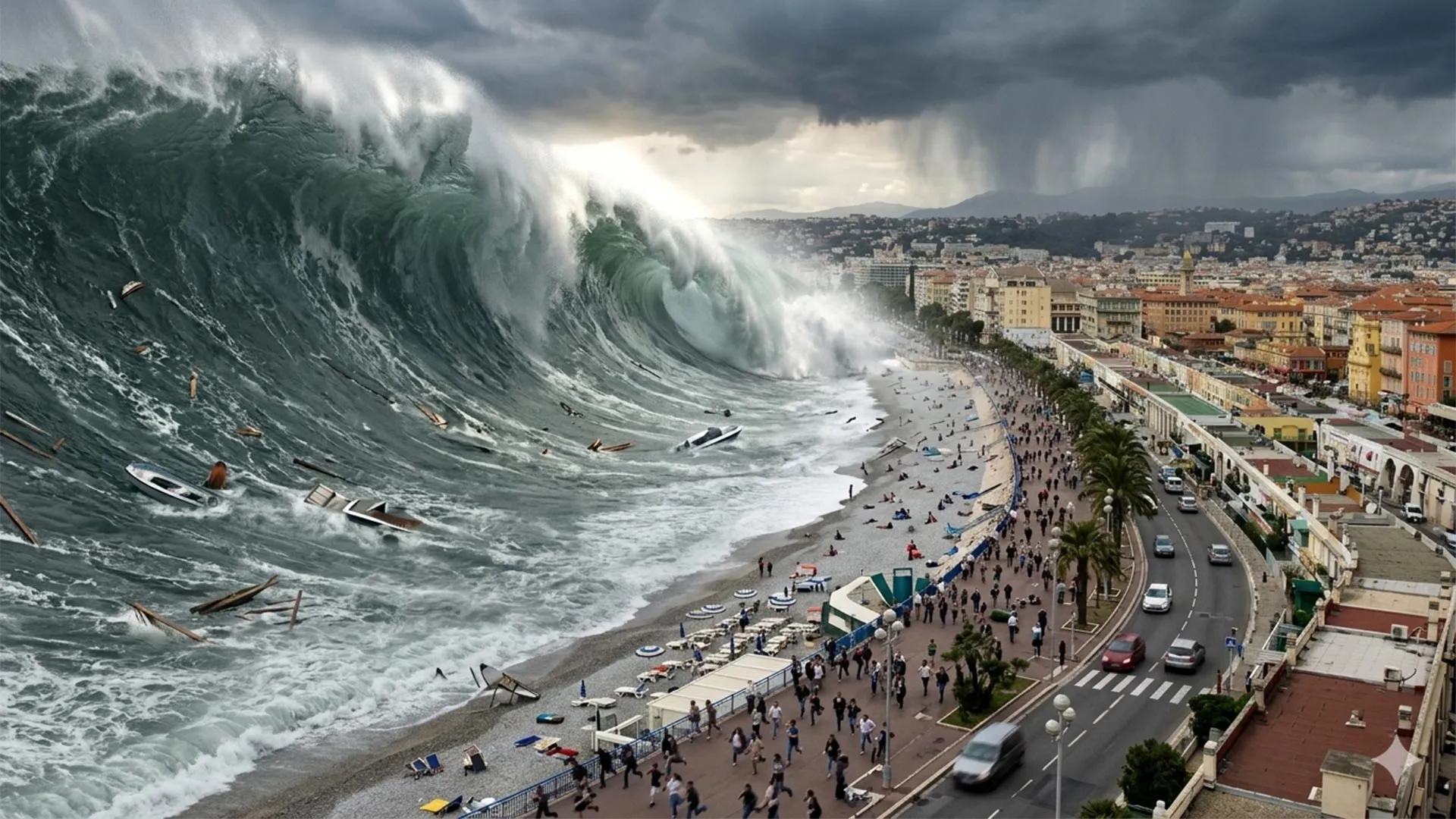
On the French Riviera, a tsunami could arrive before a warning reaches people on the beach. In some local scenarios, the first waves could reach shore in under 10 minutes. France's national warning center, meanwhile, is designed to send its initial alert to authorities within 15 minutes of a potentially dangerous earthquake. Those two timelines leave no room for delay.
That is why researchers and local officials around Nice are doing more than improving alerts. They are mapping walking routes, identifying refuge sites, and helping residents and visitors recognize when they need to leave the coast immediately. The goal is to make the first decisions before an emergency begins, rather than after the sea starts behaving strangely.
What UNESCO's Mediterranean Tsunami Warning Means
The Mediterranean is often treated as an unlikely setting for a tsunami. UNESCO has warned against that assumption. On June 22, 2022, the organization stated that "the probability of a tsunami wave exceeding 1 meter in the Mediterranean in the next 30 years is close to 100%."
The details matter. That estimate concerned an event somewhere in the Mediterranean basin over the following three decades, roughly through 2052. It was not a prediction of an imminent disaster, a guarantee that the French Riviera would be struck, or a forecast that every Mediterranean coastline would experience the same waves.
Nevertheless, the region has the ingredients needed to generate dangerous tsunamis. Earthquakes can occur along active faults in the Ligurian Sea, near the French and Italian coasts. Farther south, the movement of the African and Eurasian plates creates another source of potentially powerful earthquakes off North Africa. Underwater landslides provide an additional, sometimes much more local, trigger.
The Danger Is Not Just a Giant Wave
A tsunami begins when a large volume of water is suddenly displaced, often by an earthquake, landslide, or volcanic eruption. The disturbance spreads outward, potentially traveling long distances before reaching the coast. Historically called tidal waves, raz-de-marée in France or maremoti in Italy, tsunamis can bring both sudden flooding and extremely powerful currents.
They do not always resemble the towering wall of water people imagine. A tsunami can appear as a rapid rise or retreat of the sea, followed by repeated surges. Flooding can range from centimeters to several meters, while fast currents can exert forces equivalent to several tons per square meter against coastal structures. The first wave is not necessarily the largest.
Even relatively small tsunamis deserve attention. Italy's National Institute of Geophysics and Volcanology notes that a tsunami with an amplitude of just 50 centimeters can be dangerous because of the energy and sustained movement of the water, which can behave more like a rushing torrent than ordinary surf.
Globally, tsunamis have killed more than 250,000 people since 1970. The December 26, 2004, Indian Ocean disaster and the March 11, 2011, tsunami in Japan account for much of that devastating toll.
The French Riviera Has Been Hit Before
The Montpellier researchers describe the Mediterranean as having the largest historical tsunami record after the Pacific. Along the French Riviera, they cite roughly 20 reported events between the 16th century and the early 2000s, including waves exceeding two meters. Several episodes show how differently the danger can unfold.
On February 23, 1887, an earthquake in the Ligurian Sea, with an estimated magnitude between 6.5 and 6.8, triggered a tsunami along the coast. Historical accounts describe the sea falling by about one meter in Antibes and Cannes, leaving fishing boats stranded. Waves approaching two meters then swept over the beaches.
A very different event occurred on October 16, 1979. Part of the construction site for a new commercial port in Nice (Alpes-Maritimes), beside the airport, collapsed into the sea. The resulting landslide and tsunami caused eight deaths, according to a reconstruction published in Natural Hazards. Effects were reported in Nice, Antibes, and Cannes, with disturbances observed in Antibes for about half an hour. The later study found that water reached elevations of 3.5 meters locally and flooded as far as 150 meters inland.
The May 21, 2003, Boumerdès earthquake (Algeria) demonstrated that the trigger could also lie across the Mediterranean. Its effects reached the Riviera about 75 minutes later. Investigators documented abrupt sea level drops (from 50 cm to 1.5 m), partially emptied harbor basins, swirling water, strong currents, and damaged boats in eight marinas. Harbor resonance, in which the shape of a basin reinforces the water's oscillations, helped explain why neighboring ports experienced different effects.
Mediterranean tsunamis are not confined to those older events. On December 4, 2022, a flow of hot volcanic material entered the sea at Stromboli and generated a small tsunami, activating the island's warning system. Italy's geological institute reported no damage, but the event provided another reminder that the region's tsunami activity is real and ongoing.
Why an Alert May Not Be Enough
France has operated its national tsunami warning center, the Centre d'alerte aux tsunamis (Cenalt), since July 2012. Working within the international system coordinated by UNESCO, it monitors earthquakes that could generate tsunamis and sends initial messages to French emergency authorities and other warning centers.
The warning then has to reach the public. In France, the chain includes the interdepartmental crisis management operational center (Cogic), followed by authorities responsible for issuing instructions. One channel is FR-Alert, which can send notifications to mobile phones in the threatened area. Detecting an earthquake and getting people moving are therefore separate steps.
Distance makes a crucial difference. A tsunami generated off North Africa may take less than 90 minutes to reach the Riviera. A nearby source in the Ligurian Sea, between Corsica and the Italian coast, can leave far less time. Local landslides are particularly challenging because their effects can develop quickly and may not be preceded by a felt earthquake. A functioning warning system cannot always overcome such a short travel time.
Mapping a Way Off the Beach
Planning starts with identifying where evacuation may be necessary. French government agencies and the University of Montpellier have defined a coastal evacuation zone using elevation, distance from the sea, and historical information. It generally covers land below five meters in elevation and within 200 meters of the shoreline. Around river mouths, the distance extends to 500 meters from the estuary. These are planning boundaries, not a prediction that a future wave will be five meters high.
Across the French Mediterranean coast, including Corsica, that zone encompasses about 1,700 kilometers of coastline, 187 towns, and at least 164,000 residents. At the height of summer, planners must also consider an estimated 835,000 beach users. Those figures describe the scale of potential evacuation planning, not a forecast that one tsunami would affect everyone at once.
In the Nice Côte d'Azur metropolitan area, dense development and heavy tourism make the challenge especially demanding. The research team used photographs and computer modeling to estimate beach attendance (between 10,000 and 87,000 people on the beaches, depending on the season and time of day).
Researchers at the University of Montpellier's Laboratory of Geography and Land Planning have developed evacuation routes that account for slopes, obstacles, walking speeds, and potential bottlenecks. Rather than simply drawing a line inland, their algorithms identify the fastest walking routes to refuge sites beyond "waves' reach," which local authorities have validated. Nearly 100 refuge sites have been incorporated into operational evacuation plans.
Nice Has Now Earned Tsunami Ready Recognition
The preparedness effort has moved beyond a future ambition. In June 2026, UNESCO announced that the Nice Côte d'Azur metropolitan area had received Tsunami Ready recognition.
UNESCO's Tsunami Ready international recognition program (TRRP) evaluates communities against 12 indicators covering risk assessment, preparedness, and emergency response. Requirements include evacuation maps, public education, an approved response plan, and reliable ways to receive and distribute official alerts around the clock. Recognition must be renewed every four years.
Nice follows earlier work in Deshaies, Guadeloupe, which received recognition in 2023, and Cannes, which became the first municipality in mainland France to receive it in January 2024. Montpellier researchers provided scientific and technical support for both communities. Their methods offer a foundation for similar work elsewhere in France, Europe, and overseas territories.
Maps alone, however, cannot ensure that people know how to use them. The Nice project also includes public signs, evacuation exercises, and educational activities involving schools and Montpellier students. A publicly accessible interactive platform lets people check evacuation zones, routes, and instructions before they need them.
Experience in Japan shows why that preparation matters. A GNS Science review of the 2011 disaster reported a 96% survival rate among people in inundated areas and highlighted the importance of education and evacuation procedures. The same review warned that waiting too long for official information can delay escape.
The Most Important Decisions Come Before the Wave
A felt earthquake or unusual movement of the sea may be the first warning available. A sudden retreat can be a danger sign, but it does not happen before every tsunami. The sea may instead rise rapidly, and some local events may offer little obvious advance notice.
Nice's guidance tells people in threatened coastal areas to move inland on foot toward higher ground when an alert is issued or natural warning signs appear. Drivers should stop safely and continue on foot. During an earthquake, people should first protect themselves from the shaking, then move to safety as soon as they can. The priority is to follow designated evacuation routes and local instructions, not wait for a better view of the water.
Reaching safety is not the end of the response. Later waves can be larger, and dangerous currents may continue for hours. People should remain outside the evacuation zone until authorities say it is safe to return.
For the French Riviera, the lesson is straightforward: an alert is valuable, but knowing where to go can be just as important. When the first wave may be only minutes away, the time to work out an escape route is before the emergency begins.
Story Source:
Materials provided by ScienceDaily.com. Note: Content may be edited for style and length.
Cite This Page: